JU student contributes to a major archaeological discovery

(source: PNAS)
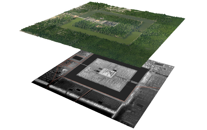
Lidar mapping of the area around Angkor Wat temple, showing traces of urban grid on both sides of the moat
A team of archaeologists conducting excavations in Cambodia has made a major discovery within a research project which aims at exploring the historical settlement patterns in the region. The student of the Jagiellonian University Institute of Archaeology, Kasper Hanus has been among the members of the expedition, whose achievements have been classified among top ten discoveries of 2013 by the Archaeology magazine of the Archaeological Institute of America.
The project involved surveying Angkor urban complex, which was the heart of the Khmer Empire during the period 802 - 1432 AD with airborne laser sensing technology (LIDAR). The results were astonishing, as it turned out that the gridded urban space covered much larger area then it was previously thought, contradicting the traditional views on Khmer settlement patterns, which assumed that physical barriers such as walls and moats used to define the "genuine urban" areas.
It has been indicated that the gridded urban space was present on both sides of the famous moat of Angkor Wat temple complex and outside the walls surrounding the centre of the 12th century Khmer capital, Angkor Thom. The findings suggest that the land area covered by the city was four times larger than it was previously thought. The urban landscape was characterised by a dense urban core and large suburbs with a number of secondary centres.
The findings seem to support the theory that it was the overgrowth of Angkor's urban complex that contributed to the city's eventual decline.
Sources: PAP Nauka w Polsce, Archaeology

